Ubuy Africa
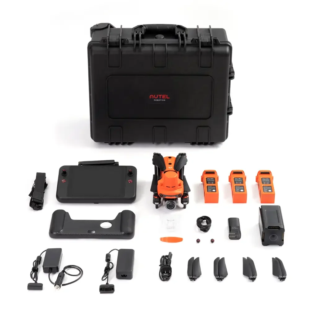
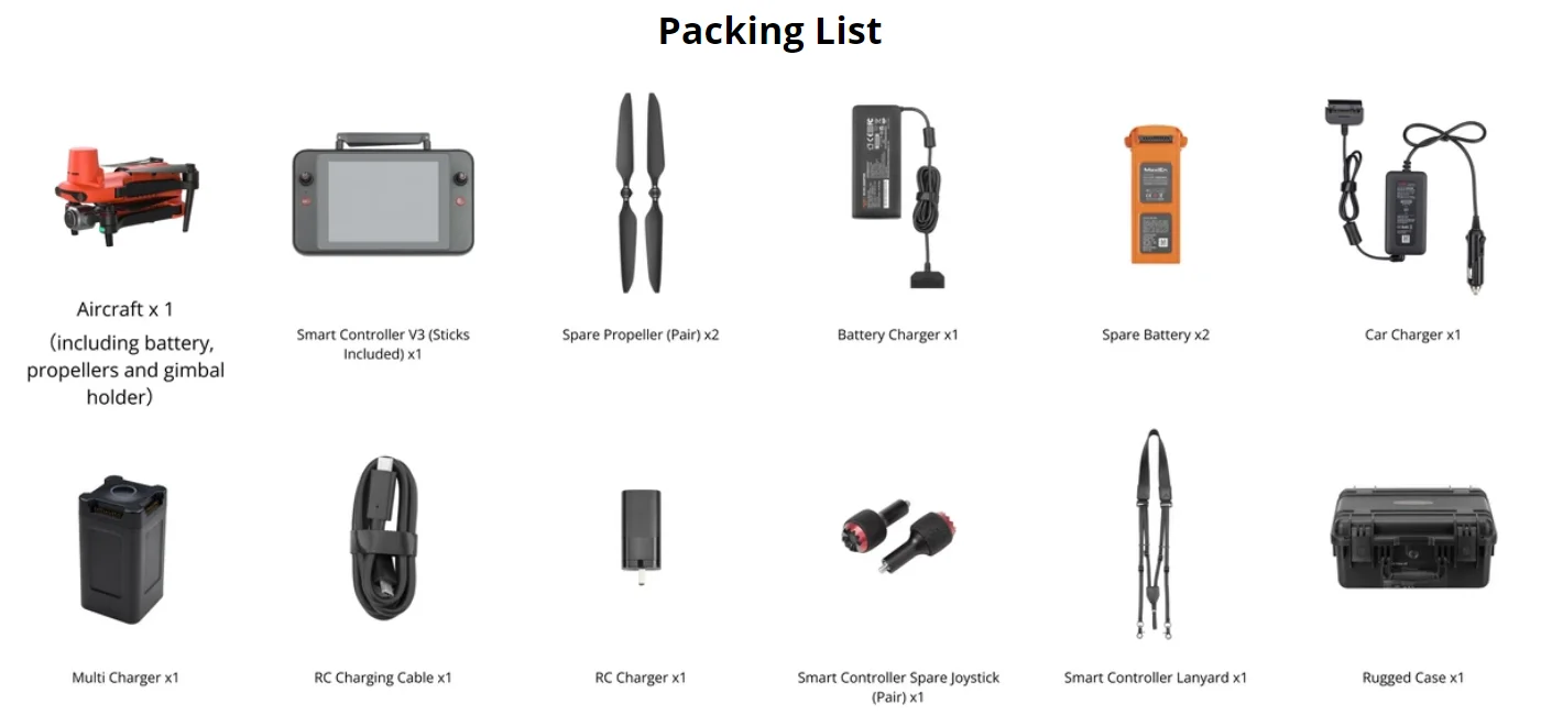
Autel Robotics EVO II Pro RTK V3 Drone Rugged Bundle 20MP Photo& 6K/30fps Video Professional Surveying & Mapping Drone In Stock
Autel Robotics EVO II Pro RTK V3 Drone Rugged Bundle 20MP Photo& 6K/30fps Video Professional Surveying & Mapping Drone In Stock
Couldn't load pickup availability
SPECIFICATIONS
APP Supported Languages: English,Simplified Chinese
Aerial Photography: Yes
Aircraf Operating Frequency: 2.4GHz,other,5.8GHz
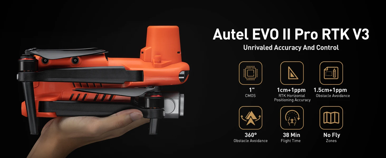
Autel Robotics Model: EVO II Pro RTK V3
Battery Weight[g]: 365g
Brand Name: AUTEL ROBOTICS
Built-in Display: No
Camera Features: 6K HD Video Recording
Camera Integration: Camera Included
Camera Mount Type: 3-Axis Gimbal
Camera Stabilization: Gimbal Image Stabilizer
Category: Camera Drone
Certification: CE,FCC
Connectivity: APP Controller
Control Channels: 4 channels
Display Control: Yes
Display size["]: 7.9inch
Drone Battery Capacity: 7100 mAh
Drone Control Methods: Remote controller control
Drone Weight: 1237g
Equipped with Aerosol Spraing System/Spread Tank Volume: No
Expandable storage: other
FPV Operration: No
Flight Time: others
Frequency: 900M/2.4G/5.2G/58GHz
GPS: Yes
Hign-concerned Chemical: None
Integrated propeller guard: Include
Internal Storage: 8G
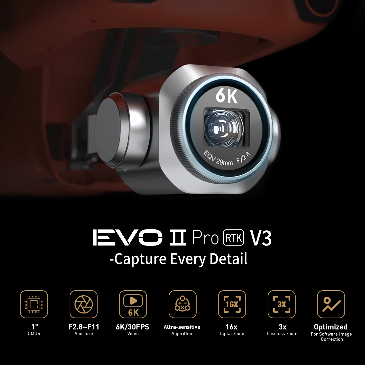
Lens Aperture[f/Number]: f/2.8 - f/11
Loudspeaker: No
Max Ascent Speed[m/s]: 8
Max Descent Speed[m/s]: 4
Max Flight Time: 38Min
Max Takeoff Weight: 1-2KG
Max Wind Speed Resistance: 20 - 30 KM/H
Maximum Altitude[m]: 5000
Maximum Horizontal Speed[m/s]: 20
Maximum expandable storage: 256G
Motor Type: Brushless Motor
Obstacle avoidance types: Visual avoidance
Origin: Mainland China
Pixels: 20 million
RTK Module(Real-time kinematic): Yes
Remote Controller Battery Capacity[mAh]: 5800
Remote Distance: 10km
Removable/Replaceable Battery: Yes
Sensing Type: Complete Omnidirectional
Sensor Size: 1/1.0 inches,1/1.0 inches
Spotlight: No
Stobe: No
Transmission Range: 10km
Video Format[Name/Type]: MP4,MOV
Video Maximum Resolution[Pixel X Pixel]: 6K(5780*2890)
Autel Robotics EVO II Pro RTK V3 Drone Rugged Bundle 20MP Photo& 6K/30fps Video Professional Surveying & Mapping Drone In Stock
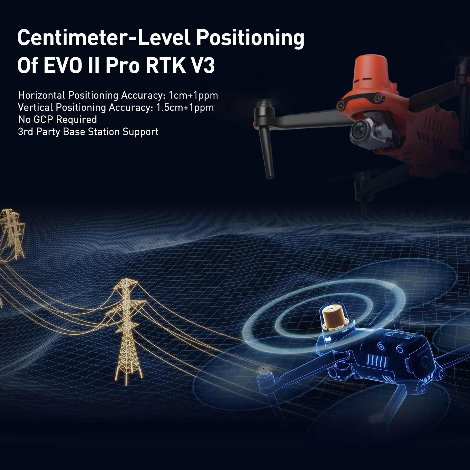
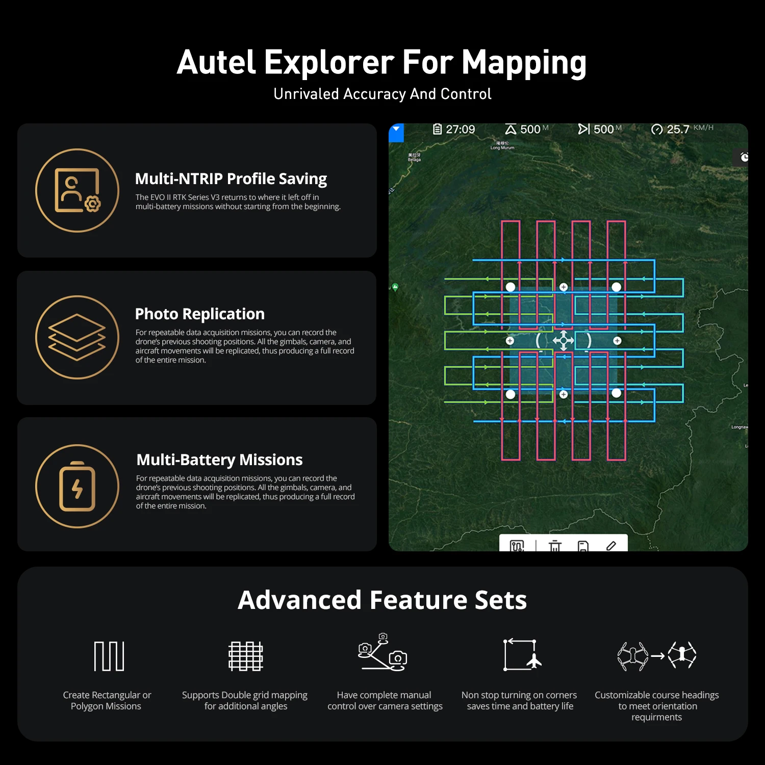
Centimeter-Level Positioning
The EVO II RTK V3 introduces a brand-new RTK module, which provides real-time centimeter-level positioning data and supports Post-Processing Kinematic (PPK). The aircraft can record the original satellite observation data, camera exposure parameters, and more. The positioning system supports an RTK base station and NTRIP RTK network, which help to achieve accurate and stable data acquisition in complex operation environments.
Multi-NTRIP Profile Saving
For repeatable data acquisition missions, you can record the drone's previous shooting positions. All the gimbals, camera, and aircraft movements will be replicated, thus producing a full record of the entire mission.
Photo Replication
For repeatable missions, you can record the drone's previous shooting parameters. The gimbal, camera, and movement settings will be replicated, allowing missions to be easily duplicated.
Multi-Battery Missions
The Explorer App allows the user to create and save multiple NTRIP profiles for different locations, so they don't have to input new a flight plan for every new location manually.
Zoom In For The Details
EVO II Pro RTK V3 has optimized its datasets to be easily adjusted with post-processing software applications.
Optimized For Software Image Correction
EVO II Pro RTK V3 has optimized its datasets to be easily adjusted with post-processing software applications.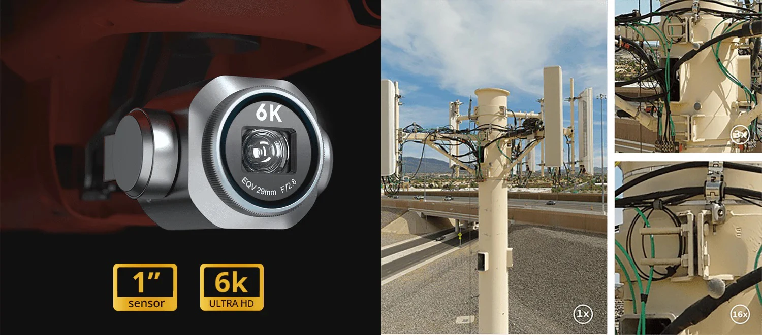
360° Obstacle Avoidance
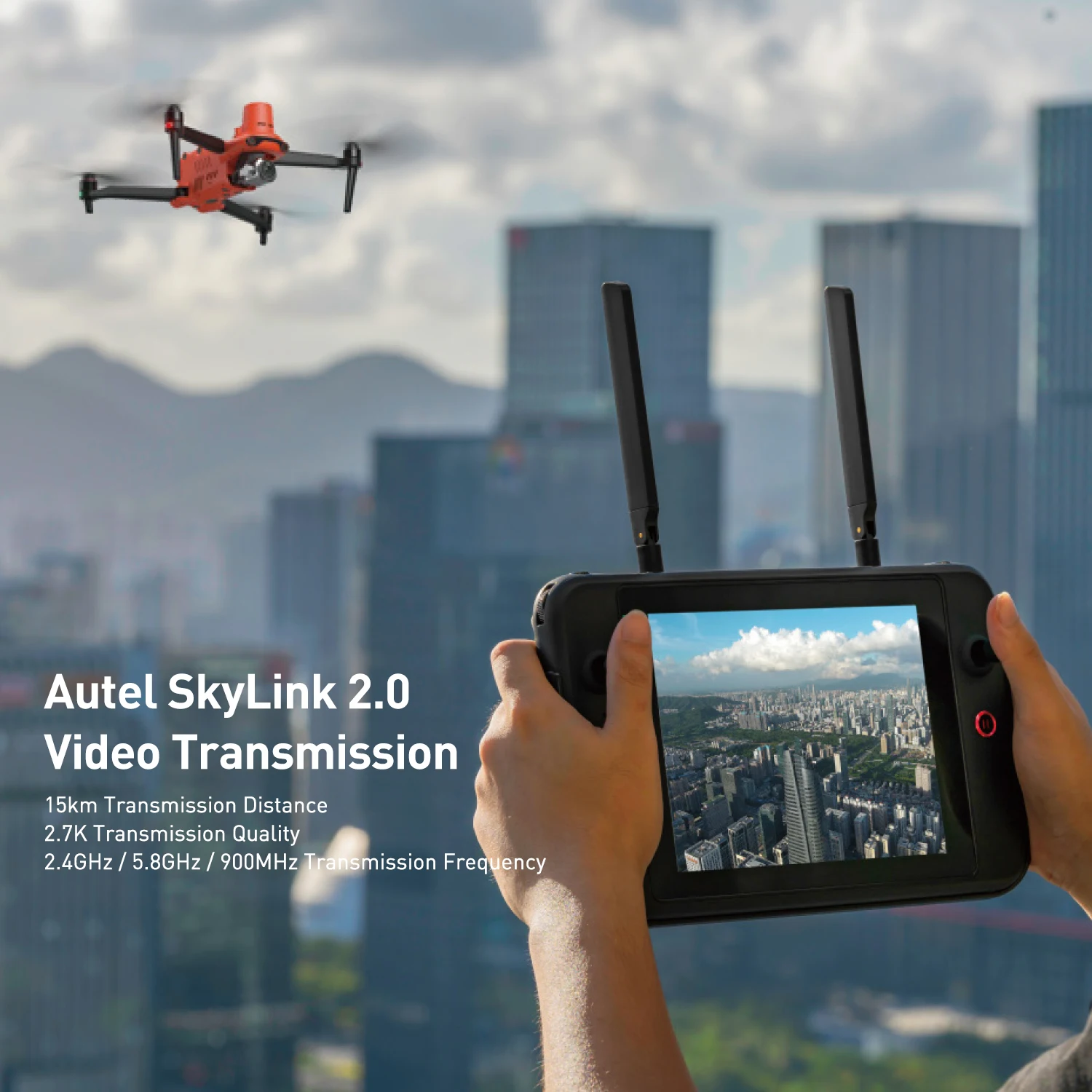
Equipped with 19 groups of sensors including 12 visual sensors, the main camera, ultrasound, IMUs, and other sensors enables the building of three-dimensional maps and path planning in real-time. Autel SkyLink 2.0 Video Transmission
SkyLink 2.0 is built into the EVO II V3 chipset, expanding the possibilities for your most critical workflows.